ILIAD – Digital Twin of The Ocean
Feb2022 – Jan2025 56 partners € 17 999 998,75
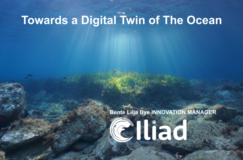
Iliad aspires to be an interoperable, data-intensive, and cost-effective Digital Twin of the Ocean
The Iliad Digital Twin of the Ocean, an EU funded project, builds on the assets resulting from two decades of investments in policies and infrastructures for the blue economy and aims at establishing an interoperable, data-intensive, and cost-effective Digital Twin of the Ocean.
Iliad capitalises on the explosion of new data provided by many different Earth observation sources, advanced computing infrastructures (cloud computing, HPC, Internet of Things, Big Data, social networking, and more) in an inclusive, virtual/augmented, and engaging fashion to address all Earth data challenges. It will contribute towards a sustainable ocean economy as defined by the Centre for the Fourth Industrial Revolution and the Ocean, a hub for global, multi-stakeholder co-operation.
The Iliad Digital Twin of the Ocean will fuse a large volume of diverse data, in a semantically rich and data agnostic approach to enable simultaneous communication with real world systems and models. Ontologies and a standard style-layered descriptor will facilitate semantic information and intuitive discovery of underlying information and knowledge to provide a seamless experience.
The combination of geovisualisation, immersive visualization and virtual or augmented reality allows users to explore, synthesize, present, and analyze the underlying geospatial data in an interactive manner.
To realize its potential, the Iliad Digital Twin of the Ocean will follow the System of Systems approach, integrating the plethora of existing EU Earth Observing and Modelling Digital Infrastructures and Facilities.
To promote additional applications through Iliad Digital Twin of the Ocean, the partners will create the Iliad Marketplace, included a market for Geosciences related applications and services. Like an app store, providers will use the Iliad Marketplace to distribute apps, plug-ins, interfaces, raw data, citizen science data, synthesized information, and value-adding services derived from the Iliad Digital Twin of the Ocean. It will also be an efficient way for scientists to discover and find relevant applications and services.
NextGEOSS – Next Generation GEOSS for Innovation Business
Dec2016 – Nov2020 H2020 27 partners € 9 999 998,75
![]()
WP8 Lead BLB
NextGEOSS project
The NextGEOSS project, a European contribution to GEOSS, proposes to develop the next generation centralised hub for Earth Observation data, where the users can connect to access data and deploy Earth Observation based applications. The concept revolves around providing the data and resources to the users communities, together with Cloud resources, seamlessly connected to provide an integrated ecosystem for supporting applications. A central component of NextGEOSS is the strong emphasis put on engaging the communities of providers and users, and bridging the space in between.
The project has a special focus on encouraging and stimulating data exploitation by businesses.
Capacity building is at the heart of NextGEOSS and the project will identify training needs to encourage wider user-engagement with Earth Observation data and its commercial potential in the next 3,5 years.
EO4Agri – Bringing together the Knowledge for Better Agriculture Monitoring
Nov 2018 – Oct 2020 11 partners H2020 CSA € 2 762 015 https://cordis.europa.eu/project/id/821940
![]()
WP5 Leader on behalf of Plan4all, Contributors to WP6
The main objective of EO4AGRI is to catalyze the evolution of the European capacity for improving operational agriculture monitoring from local to global levels based on information derived from Copernicus satellite observation data and through exploitation of associated geospatial and socio-economic information services.
EO4AGRI assists the implementation of the EU Common Agricultural Policy (CAP) with special attention to the CAP2020 reform, to requirements of Paying Agencies, and for the Integrated Administration and Control System (IACS) processes.
EO4AGRI works with farmers, farmer associations and agro-food industry on specifications of data-driven farming services with focus on increasing the utilization of EC investments into Copernicus Data and Information Services (DIAS).
EO4AGRI addresses global food security challenges coordinated within the G20 Global Agricultural Monitoring initiative (GEOGLAM) capitalizing on Copernicus Open Data as input to the Famine Early Warning System Network (FEW-NET).
EO4AGRI assesses information about land-use and agricultural service needs and offers to financial investors and insurances and the potential added value of fueling those services with Copernicus information.
The EO4AGRI team consists of 11 organizations, complementary in their roles and expertise, covering a good part of the value-chain with a significant relevant networking capital as documented in numerous project affiliations and the formal support declarations collected for EO4AGRI. All partners show large records of activities either in Copernicus RTD, governmental functions, or downstream service operations. The Coordinator of EO4AGRI is a major industrial player with proven capacities to lead H2020 projects.
The EO4AGRI project methodology is a combination of community building; service gap analysis; technology watch; strategic research agenda design and policy recommendations; dissemination (incl. organization of hackathons).
EGIDA – Coordinating Earth and Environmental cross-disciplinary projects to promote GEOSS
Sep 2010 – Dec 2012 FP7 CSA 13 partners Budget € 994 656 (BLB € 80 250)
https://cordis.europa.eu/project/id/265124
Summary
EGIDA will prepare a sustainable process promoting coordination of activities carried out by: the GEO Science & Technology (S&T) Committee; S&T national and European initiatives; and other S&T Communities. This will be done by supporting broader implementation and effectiveness of the GEOSS S&T Roadmap and the GEOSS mission through coherent and interoperable networking of National and European projects, and international initiatives. EGIDA will deliver evaluation processes, tests and assessment indexes, expertise databases, a “GEO Label” concept, surveys, and other instruments that will link relevant European S&T communities to GEOSS and ensure it is built using state-of-the-art science and technology. Through co-ordination with the GEOSS S&T Committee (five co-chairs are involved in EGIDA), these deliverables will contribute strongly to the GEO S&T Roadmap implementation.
For European countries, EGIDA will deliver the EGIDA Methodology, a sustainable mechanism based on the GEO S&T approach at national and regional level, to coordinate national multi-disciplinary “System of Systems”. This builds on existing national initiatives and European projects, and facilitates the European S&T Community contributions to and interactions with GEOSS. The EGIDA Methodology will improve development and management of S&T infrastructures (i.e. sensors, data, processing services, and environmental modelling infrastructures), supporting mobilization of the resources needed to contribute effectively to GEOSS.
EGIDA will involve developing countries by transferring the EGIDA S&T methodology to them and implementing three specific use cases: two regional use-cases (Balkan region, Mediterranean region) and a pan-European thematic use-case (Air Quality and Health). EGIDA will be embedded within a wide Network of Stakeholders selected to represent the various actors (science teams and institutions, S&T programmes, GEO components) and the scientific fields relevant to the nine GEOSS SBAs.
Periodic Report Summary – EGIDA (Coordinating Earth and Environmental cross-disciplinary projects to promote GEOSS)
EGIDA set up and operated an Advisory Board (AB) guaranteeing a synergetic action with other relevant European and international initiatives and getting important guidance on the project activities and outcomes (e.g. from the STC members who sit in the board). A first AB meeting was held in Bonn.
EGIDA set up and operated a Stakeholder Network (SN) providing a link between the EGIDA project and the broad European and international S&T community relevant to GEO. Two SN meetings were held in Rome and Bonn.
Jointly with GEO and EC, EGIDA organised three workshops:
EGIDA organized a workshop (back-to-back with the GEO STC-15) entitled: “1st STC-EGIDA joint Workshop” (Rome, Sep 2011).
EGIDA (lead by ISPRA) organized and hosted a meeting entitled “Workshop on the National initiatives for implementing EO/GEOSS” (Rome, Apr, 2011).
In collaboration with the University of Bonn, EGIDA organised the “1st Joint Workshop of the EGIDA Stakeholder Network and Advisory Board Connecting GEOSS and its Stakeholders in Science and Technology” (Bonn, May 2011).
EGIDA established a collaboration with the FP7 projects BALKANGEONET and OBSERVE as far as: registration of scientific data sets and the EGIDA methodology transfer. The three projects are organising a workshop at the next GEO plenary in Istanbul (Nov 2011).
As to dissemination and outreach, EGIDA worked out two newsletters, started a LinkedIn group, produced articles and interviews on the IEEE Earthzine journal, gave presentations of the project at significant conferences (e.g. IEEE IGARSS, AGU, EGU) and workshops (e.g. GEPWS, AirQuality CoP workshop), and produced an initial list of relevant Conferences and Workshops and an initial Directory of relevant Science Networks.
EGIDA worked out draft documents discussing: the “Process for communicating the scientific priorities in Earth Observation”; the “Methodology and process for the evaluation of the relevance of specific observation infrastructure”, and the “Continuity indicator for GEOSS components” are under consideration by the STC co-chairs and will be finalised after having received the necessary feedbacks from the GEO ExComm (November 2011, at the GEO plenary in Istanbul).
Gender in System Design- Kjønnsperspektiv i systemdesign: Et nytt kriterium i innovasjon?
(Forprosjekt – RFFAGDER)
2012-2013 3 partners
Målet er å opprette et internasjonalt konsortium/nettverk som har interesse for kjønnsperspektiv innen systemdesign slik at en forskningssøknad for et hovedprosjekt kan utvikles. Aktuelle søknader vil være primært rettet mot EU-prosjekter (Eureka, EØS). Regionale og nasjonale foretak vil inviteres som partnere. Konsortiet skal bestå av deltagere fra akademia og bedrifter som har relevant kompetanse, interesse og motivasjon til å utvikle et prosjektforslag som integrerer et sosioteknisk kjønnsperspektiv i systemdesignsprosesser.
Prosjektet har følgende delmål:
1.Gjennomføre en litteraturstudie av eksisterende litteratur, samt kartlegge beste praksis fra akademia, privat og offentlig sektor. Denne studien vil danne grunnlaget/utgjøre et verktøy (diskusjonsartikkel) for å etablere nettverket og konsortiet i tillegg til å utgjøre en bakgrunn og motivasjon for hovedprosjektet.
2.Gjennomføre en innledende analyse som kan danne et grunnlag for hovedprosjektet. I hovedprosjektet ønsker vi å se på systemdesign i en community of practice (CoP) kontekst. CoP eller praksisfelleskap består av deltagere som deler kunnskap relatert til felles interesseområder. Det er interessant å forstå hvordan kjønnsperspektivet kan utgjøre et kriterium ved design av en slik sosio-teknisk kontekst med tanke på både teknologi og menneskelig sammensetning i et praksisfellesskap. BLB har arbeidet med CoP knyttet til Group of Earth Observations (GEO). Hustad og Arntzen har også forskningserfaring relatert til CoP.
3.Generere et internasjonalt forsknings- og businessnettverk med deltagere som har kompetanse relatert til sosiotekniske aspekter, kjønnsperspektiver og innovasjon som har relevans for både ?kjønnsperspektiv i systemdesign? og Agder-regionen.
4.Opprette en webside som skal støtte kommunikasjon og informasjonsdeling for prosjektdeltagerne og det etablerte konsortium.
5.Diskusjonsgrupper på sosiale medier er tenkt opprettet (eks. Linked-In)
GAGOS –
Assessing and forward planning of the Geodetic And Geohazard Observing Systems for GMES applications
Summary (abstract from final report)
The GAGOS project provides an assessment of the state-of-the-art of two major components
of the Earth observing system, namely the global geodetic and global geohazards observing
systems as indispensible preqequisites for the consistent global monitoring of the Earth
system environment and security aspects of population. The assessment was carried out in
view of the three major goals of the Global Monitoring for Environment and Security
(GMES) project, namely (1) to provide information for the definition, negotiation,
implementation and verification of the European environmental policies, national regulations
and international conventions, (2) to be a contribution to global monitoring of the Earth
system environment aiming at the provision of the data and information base required for a
successful quest for sustainable development, and (3) to constitute, on a regional and global
level, monitoring capacities required to ensure security for the population. The compliance of
the networks and data systems of IGOS-P (Integrated Global Observing Strategy Partnership)
and GEO (Group on Earth Observation) with GEOSS (Global Earth Observation System of
Systems) were taken into account. The assessment also considers criteria such as the overall
continuity, comparibility of the in-situ observations with space data, interoperability,
synergies through co-location. Particular focus of the assessment is on the existing
infrastructure to monitor geohazard related parameters and thus, the results of the project are
essential to improve the observational networks in order to provide information for better
understanding of processes and risks for natural hazards and eventually also mitigation and
management of disasters. It strengthens the European Research Area through trans-national
cooperation and addresses the potential synergies through an integrated approach to Earth
observation, data management and spatial data information systems. Thus the GAGOS
project has a profound effect not only on global Earth system monitoring for sustainable
development, but also a large number of services for the security of the society such as
disaster warning, assessment of natural hazard risks, estimation of post-hazard damages,
rescue aids and many other applications.
The assessment of the status quo was performed in the following fields: (1) Reference frames
and Earth orientation parameters, (2) Earth physical shape and gravity field, (3) geohazards,
(4) man-made problems and monitoring of infrastructure, and (5) data acquisition, data flow,
data archiving and data information management. The assessment of the current situation was
compared to the present and future requirements and the adaption required to fully exploit
new technologies for the benefit of various users was outlined. Towards this aim a forward
planning was performed to close the deficiencies and gaps of the present situation.
Recommendations for future global geodetic and geohazards observing systems to serve
applications within GMES are provided. Finally, the GAGOS project addresses the European
activities and contributions to the implementation of the Global Geodetic Observing System
(GGOS), a component of the International Association of Geodesy (IAG).
IAG GGOS implementation plan (2005)
TRANSFER: Tsunami Risk ANd Strategies For the European Region
WP4 leader: Analysis of Instrumental (Seismic, Geodetic, Marine) Signals and Networks for the
Development of Tsunami Early Warning Systems (TEWS)
Transfer (30 partners FP6)
Summary of Wp4: Instrumental data of tsunamis and on tsunamigenic events in the Mediterranean are very scarce. Therefore developing algorithms for real-time determination of tsunamigenic sources (for instance a submarine earthquake) has mainly to be carried out in the absence of tsunami records. The risk is that methods that are tested on non-tsunamigenic sources (e.g. on intermediate-magnitude on-land earthquakes) could fail in case of a tsunami generation event (e.g. a large submarine earthquake). This risk reflects also on the development of the Tsunami Early Warning System, and indeed affects and will affect the TEWSs in all the world oceans, even in the Pacific.
Summary of project 2006-2009
The project main goal is to contribute to our understanding of tsunami processes in the Euro-Mediterranean region, to the tsunami hazard, vulnerability and risk assessment and to identifying the best strategies for reduction of tsunami risk. Focus will be posed on the gaps and needs for the implementation of an efficient tsunami early warning system (TEWS) in the Euro-Mediterranean area, which is a high-priority task in consideration that no tsunami early warning system is today in place in the Euro-Mediterranean countries. The main items addressed by the project may be summarised as follows. The present Europe tsunami catalogue will be improved and updated, and integrated into a world-wide catalogue (WP1). A systematic attempt will be made to identify and to characterise the tsunamigenic seismic (WP2) and non-seismic (WP3) sources throughout the Euro-Mediterranean region. An analysis of the present-day earth observing and monitoring (seismic, geodetic and marine) systems and data processing methods will be carried out in order to identify possible adjustments required for the development of a TEWS, with focus on new algorithms suited for real-time detection of tsunami sources and tsunamis (WP4). The numerical models currently used for tsunami simulations will be improved mainly to better handle the generation process and the tsunami impact at the coast (WP5). The project Consortium has selected seven test areas in different countries. Here innovative probabilistic and statistical approaches for tsunami hazard assessment (WP6), up-to-date and new methods to compute inundation maps (WP7) will be applied. Here tsunami scenario approaches will be envisaged; vulnerability and risk will be assessed; prevention and mitigation measures will be defined also by the advice of end users that are organised in an End User Group (WP8). Dissemination of data, techniques and products will be a priority of the project (WP9).
ESEAS-RI European sea level service research infrastructure
Nov2002-Oct2005 20 partners FP5 CSC (Cost-sharing contract) € 2 299 786
BLB coordinator (for Norwegian Mapping Authority as Research Director)
The European Sea Level Service (ESEAS) comprises most of the sea level observing and research resources in Europe. The network of ESEAS Observing Sites will by improved and access to the scattered sea level database standardised. The extensive tide gauge data base will be utilised to study sea level variations on decadal to century time scales. An empirical model describing decadal to inter-decadal sea level variations will be derived through combination of tide gauge and satellite altimetry observations. The factors causing these variations will be identified and their contribution quantified. Particular emphasis will be on the North Atlantic Oscillation. A statistical description of the variability of extreme sea levels will be given for the entire European coasts in order to assess future risks.